
The Georgia Statewide Resilience Assessment: Charting a path to resilience for our home state
Project Overview
From the rolling mountains and orchards of North Georgia to the lowland farms and coastlines of South Georgia, communities across the state face a wide range of natural hazards that threaten lives, livelihoods, and critical infrastructure.
Resilience planning has become increasingly complex, especially in places where limited staffing, burdensome grant processes, uncertain funding and unclear returns on investment make it difficult to implement long-term improvements. Despite these challenges, resilience efforts are taking shape both within Georgia and across the United States.
Commissioned by The Pew Charitable Trusts and developed by the Institute for Resilient Infrastructure Systems at the University of Georgia, this effort presents the findings of a year-long statewide assessment to identify, implement and proactively plan for Georgia’s resilient future.
Georgia has experienced over 130 “billion dollar disasters” (exceeding $1 billion in damages) since 1980, but these events are becoming more common-fast.
“It will always cost us more to recover if we’re ill-prepared in the first place than it will if we made the initial investments and had the hard conversations up front.”
– NE/MGA convening participant

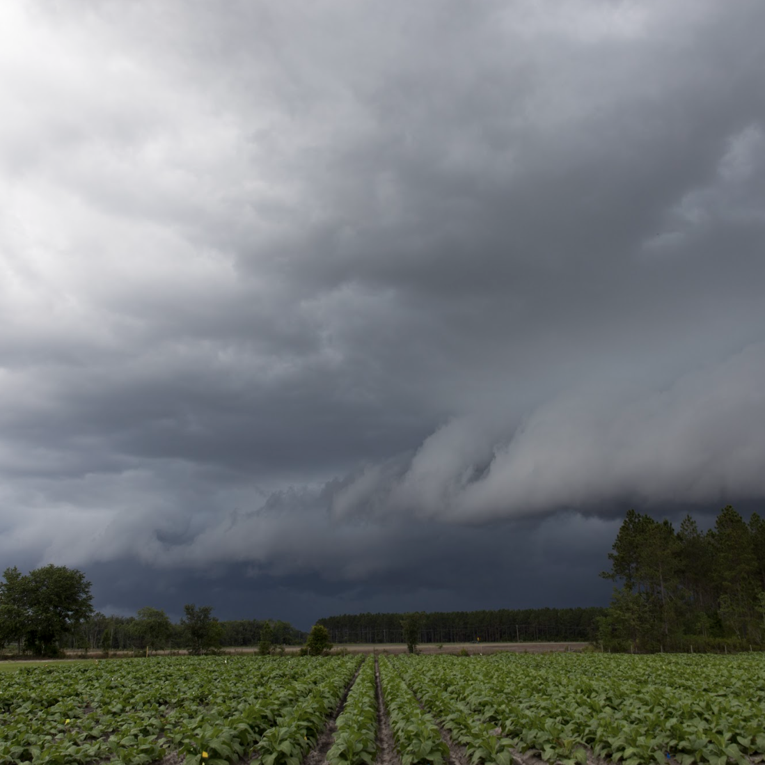
Flooding is a general and temporary condition of partial or complete inundation in two or more acres of normally dry land area (FEMA). Coastal areas often face a combination of storm surges and tidal and riverine flooding, while inland areas may experience flooding due to intense rainfall and poor drainage infrastructure.
Flooding is recognized as the most widespread and consistent hazard statewide (GEMA).
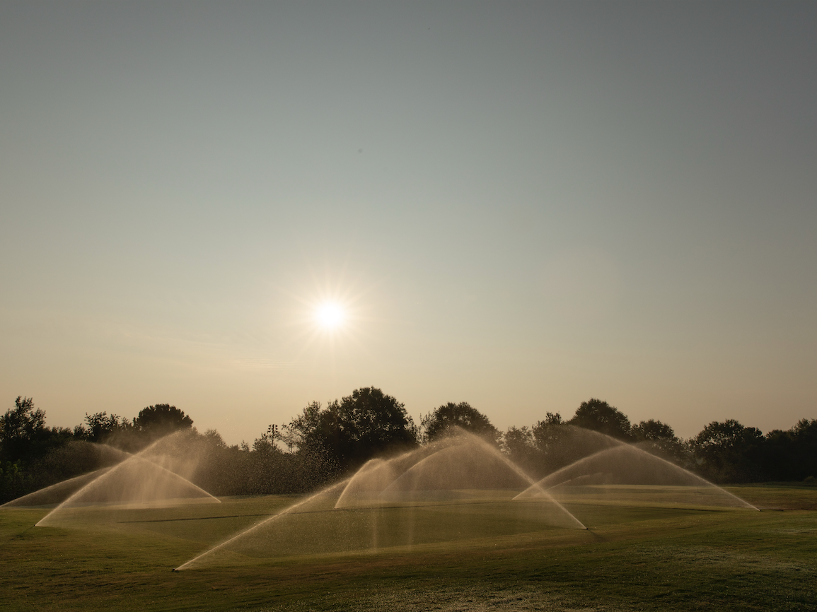
Drought is a deficiency of precipitation over an extended period of time, resulting in water shortage (FEMA). Droughts are determined by precipitation and evapotranspiration levels and can vary from short-term (less than 6 months) to much longer depending on the hydrology, climate and ecology of the region.
Georgia has faced severe periodic droughts since 1903. These periods of water scarcity, sometimes lasting several years, pose threats to water security, agriculture, wildfire risk, data center demand, energy production and more.
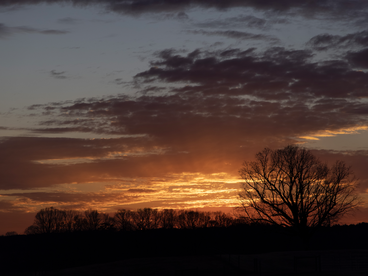
Extreme heat is defined as a temperature above 95 degrees Fahrenheit (35*C), deviating from median historic temperatures for an extended period of time (Ingram et al., 2013). These occurrences are becoming increasingly common across the Southeast in general.
Heat waves strain energy grids and water supplies and pose health and safety risks, especially for people who work outside or are unhoused, with particular impacts towards children and older adults.
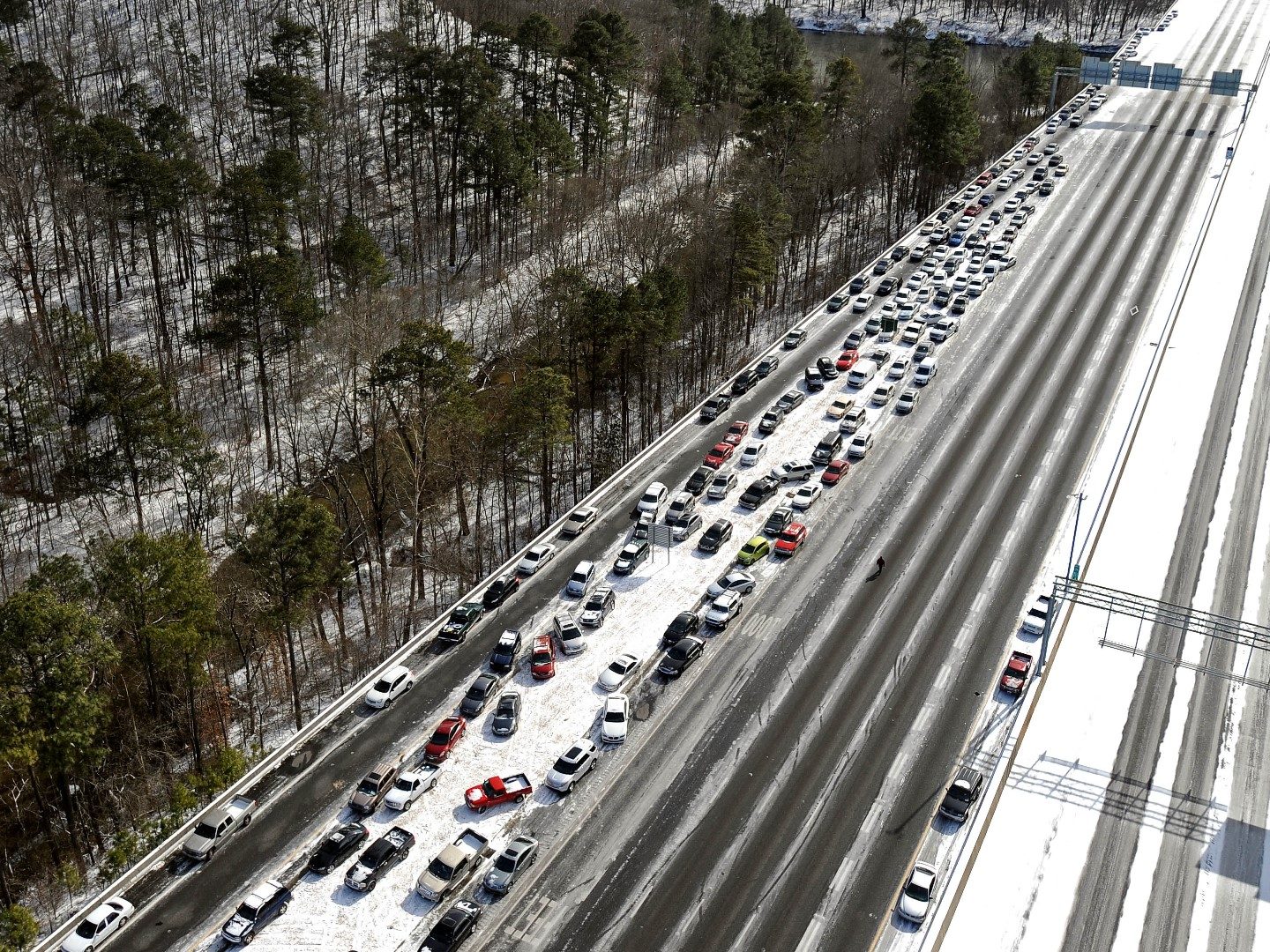
Extreme cold snaps, temperatures below 32 degrees Fahrenheit (0*C), are becoming more common in many areas, including North Georgia (Ingram et al., 2013). In the South, extreme cold is sometimes overlooked as a risk in comparison to extreme heat, but has the possibility to cause similarly significant problems.
Cold snaps pose risks to critical infrastructure, including burst service lines and pipes, road hazards and increased heating costs. Similarly to extreme heat, these periods of extreme temperature can especially harm those who work outdoors, are unhoused, or do not have indoor heating systems fit to withstand freezes.
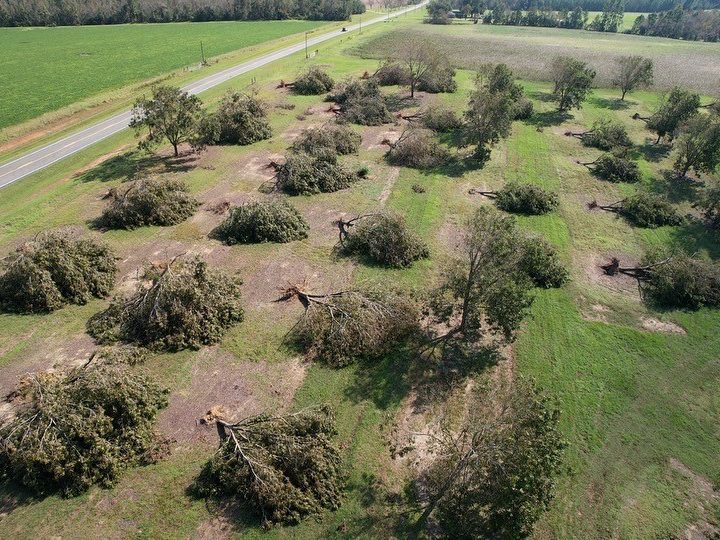
High winds exceeding 85 miles per hour are associated with severe weather like hurricanes and thunderstorms, but they can cause intense impacts on their own as these periods become increasingly frequent.
Strong winds can cause significant damage to types of structures not built to withstand them, but common throughout the state, such as mobile homes, warehouses and power lines.
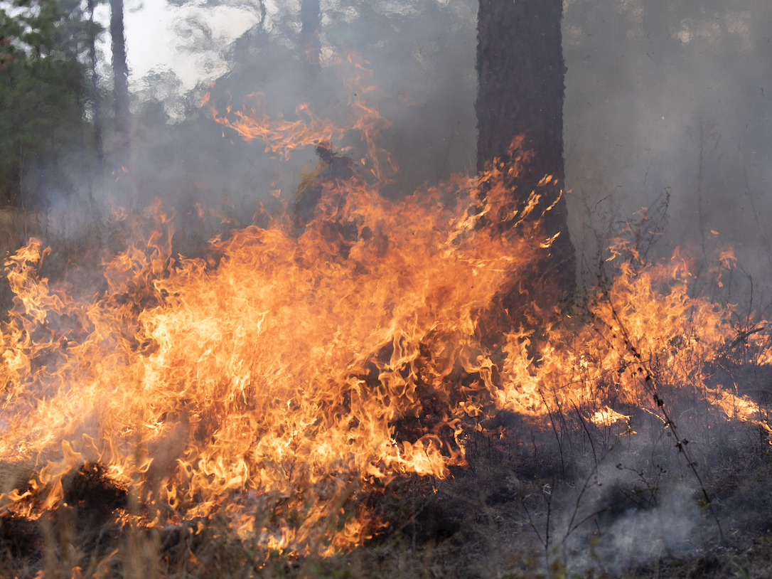
Wildfires mainly occur in forests, shrub lands, grasslands and prairies and often start due to improper debris burning (FEMA). Georgia experiences thousands of wildfires annually, with an average area of over 7 acres.
Southern Georgia is expected to be at the greatest risk for wildfire hazards, with the majority of the state’s commercial timber land. In combination with the projected increase in drought conditions, these lands are posed for significant threats of fire.
While each hazard poses risks a unique individual potential for harm, many natural hazards occur in conjunction together: a heat wave causes a drought and increases the risk for wildfire, or a hurricane causes wind damages, intense rainfall and flooding.
These combinations of hazards are known as compound hazards and often cause greater risks than each individual hazard alone. Combinations of these hazards also increase exposure and lengthen timelines for recovery, as many areas do not have the infrastructure or support to respond to multiple disasters at once.
OUT NOW: The georgia resilience assessment
georgia’s hazards, challenges, and opportunities
Over the past year, IRIS convened five roundtables, each bringing together 15-20 local and regional leaders. These roundtables culminated in a statewide convening with over 60 members from across the state.
This report aims to reflect the perspectives, concerns and insights from these conversations by offering a foundation for advancing resilience planning and strengthening Georgia’s capacity to prepare for, absorb, recover from and adapt to hazards. The report’s contents:
- Describe the natural hazards Georgia faces
- Identify challenges to addressing hazards at state, regional and local levels
- List opportunities for Georgia to grow to address these hazards
- Highlight exemplars from around the state in local and regional resilience efforts to emulate and scale up
- Provide recommendations for Georgia’s state governance to plan for hazards and build resilience
Download the full report here.
the making of the report
The material within the report is sourced from nearly a dozen in-person, virtual and ad hoc meetings with representatives from across the state in multiple sectors, held over the course of a year-long research process. Convenings were held for each region of Georgia: North, Northeast/Middle, Southeast and Southwest, with a review meeting held in Atlanta after the four regional meetings. An additional meeting was held in Augusta, Georgia, where fall 2024’s Hurricane Helene was particularly impactful.

THE TEAM
Brian Bledsoe
Director, Institute for Resilient Infrastructure Systems
bbledsoe@uga.edu
Sarah Buckleitner
Director of Communications, Institute for Resilient Infrastructure Systems
sarah.buckleitner@uga.edu
Gabrielle Pierre
Senior Research Fellow and Strategic Team Leader, College of Engineering
gpierre@uga.edu
Zak Ruehman
Senior Research Engineer, Institute for Resilient Infrastructure Systems
zruehman@uga.edu
Lynn Abdouni
Associate Research Scientist, College of Engineering
abdouni@uga.edu
Olivia Allen
Communications Coordinator, Institute for Resilient Infrastructure Systems
olivia.allen@uga.edu
Carly Ornstein
Program Coordinator, Institute for Resilient Infrastructure Systems
carly.ornstein@uga.edu
Haley Selsor
Research Professional, Institute for Resilient Infrastructure Systems
the release
Check out our webinar from July 2025 previewing the report’s release, featuring some of the people that helped make it possible:
- Brian Bledsoe, IRIS Director and project lead.
- Kristiane Huber, U.S. Conservation Officer for The Pew Charitable Trusts, who supported the project process throughout the convenings and report writing.
- Eric Fosmire, Chief of Staff and General Council for the South Carolina Office of Resilience, whose vision has helped to shape statewide policy in South Carolina for a more resilient state.
- Jackie Jackson, the Resilience Administrator for Chatham County, who helped to spearhead the Roadmap to Resilience for Chatham County, Georgia.
- Stephen Bontekoe, the Executive Director for the Limestone Valley Resource Conservation and Development Council, who partners with communities to help meet shared goals, including overseeing resilience projects.
- Lynn Abdouni, IRIS Associate Research Scientist and one of the project leads.